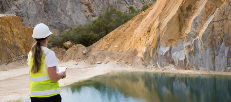
In industries like mining, infrastructure, and energy, the most important data is often hidden beneath the surface. Understanding what lies underground is key to making informed decisions, mitigating risk, and optimising operations. That’s where geo-modelling comes into play.
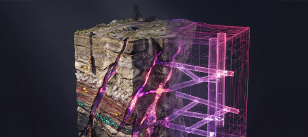
Geo-modelling is the process of creating 3D representations of geological formations using data collected from various sources, such as drill holes, seismic surveys, and satellite imagery. But in today’s fast-paced, data-driven world, traditional models are no longer enough.
At Vast Visual Creative Studio, we take geo-modelling a step further by developing fully immersive digital twins — accurate, interactive virtual replicas of physical environments. These aren’t just static models. They are dynamic visual tools that empower companies to explore, analyse, and communicate complex geospatial data like never before.
When complex subsurface data is transformed into a visually rich, interactive format, everyone benefits:
-
Technical teams gain insight
-
Executives see the big picture
-
Investors understand the opportunity
-
Communities grasp the project impact
At Vast Visual Creative Studio, we make the invisible visible. Let us help you bring your underground world to life.